


 Du Lun au Ven - De 9h à 18h

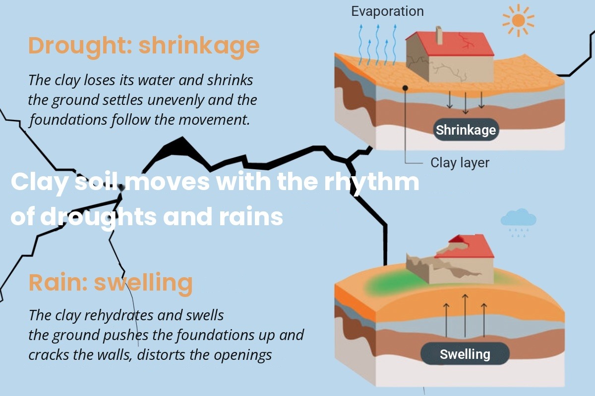
Natural ground movement caused by soil shrinkage during drought and swelling on rehydration
The scheme is based on Article 68 of the ELAN Law of 23 November 2018, codified in Articles L. 132-4 to L. 132-9 of the French Construction and Housing Code (Code de la construction et de l’habitation, CCH).
To view the text, click here
It applies only in medium- or high-exposure zones.
Areas classified as having medium or high exposure to clay shrink-swell (retrait-gonflement des argiles, RGA) can be viewed on the map of zones defined by the Order of 22 July 2020. This map was amended by the Order of 9 January 2026 (Official Journal of 31 January 2026, NOR TECP2527988A).
To view the text, click here
Key date: 1 July 2026. The 2026 map applies to preliminary sale agreements (promesses de vente) or, where there is none, to the deeds of sale, and to construction contracts entered into on or after that date. Before then, the 2020 map applied.
For a preliminary agreement signed before 1 July 2026 and completed after that date, which map should be used for the deed? In principle, the date of the preliminary agreement governs; where there is no preliminary agreement, the date of the deed.
The 2026 map can be consulted by address or by cadastral parcel on Georisques. It incorporates the zones defined on the 2020 map; a property outside the zones in 2020 may now fall within them.
1. The different situations depending on the type of property sold
1.1. Sale of building land: the preliminary geotechnical study
The seller of undeveloped building land located in a medium- or high-exposure zone must provide a preliminary geotechnical study (known as a G1 study), annexed to the preliminary agreement or, where there is none, to the deed of sale.
1.2. Construction: design study and clay shrink-swell (RGA) certificate
For a detached house or a building with no more than two dwellings in a medium- or high-exposure zone, the builder must either follow a geotechnical design study (known as a G2 study) or apply specific construction techniques laid down by regulation.
The RGA certificate (since 1 January 2024) confirms compliance with the prevention rules on completion and accompanies the Declaration of Completion and Compliance of Works (Déclaration attestant l’achèvement et la conformité des travaux, DAACT). It applies, cumulatively, to residential or mixed-use buildings with no more than two dwellings located in a medium- or high-exposure zone.
1.3. Information for the buyer of a built property
For an existing house, exposure to clay shrink-swell (RGA) appears in the risk report (état des risques) as additional information, without any disclosure obligation under the Buyer and Tenant Information scheme (Information des Acquéreurs et des Locataires, IAL) arising solely from the map.
Outside these cases, the seller’s general duty of disclosure still applies: known cracks, insurance assessments, repair works. Stating that a property is located within a zone says nothing about the cause of any cracks observed.
2. Financial support: the clay prevention fund
Clay shrink-swell (RGA) damage falls under natural disaster insurance cover, reformed by Ordinance No. 2023-78 of 8 February 2023 (adopted on the basis of the law on differentiation, decentralisation, deconcentration and simplification of local public action, known as the 3DS Law)
To view the text, click here
and Decree No. 2024-82 of 5 February 2024
To view the text, click here
The Ordinance has applied since 1 January 2024.
The scheme is being rolled out in eleven pilot départements that are particularly exposed to, and affected by, claims linked to clay shrink-swell (RGA): Allier (03), Alpes-de-Haute-Provence (04), Dordogne (24), Gers (32), Indre (36), Lot-et-Garonne (47), Meurthe-et-Moselle (54), Nord (59), Puy-de-Dôme (63), Tarn (81) and Tarn-et-Garonne (82).
Eligibility conditions
- Owner-occupier, subject to income thresholds
- Detached house with no more than 3 levels, including basement and attic
- High-exposure zone only
- Insured dwelling
An eligibility simulator is available at fonds-prevention-argile.beta.gouv.fr.
3. Points to watch
3.1. Undeveloped building land
- Locate the parcel on the 2026 map (Géorisques) and note the date of the preliminary agreement in relation to 1 July 2026.
- In a medium- or high-exposure zone: obtain the preliminary geotechnical study before the preliminary agreement, and check that it is less than 30 years old and that the ground has not been reworked since.
- In a housing subdivision (lotissement): check that the lot being sold is identified in the single study.
- Annex the study to the preliminary agreement or, where there is none, to the deed.
3.2. Built property
- Planning permission applied for since 1 January 2024, medium- or high-exposure zone, no more than two dwellings: request the RGA certificate and check the template used (Order of 21 December 2023), the qualifications of its author and that it was attached to the DAACT.
- Works carried out since 1 January 2020: request any design study.
- Risk report less than 6 months old, provided from the first viewing, with the “compensated claims” section completed.
- Known cracks or a declared claim: request the expert’s report, the insurer’s decision and the status of the repair works.
4. Clauses to be included in the deed
- Preliminary agreement signed before 1 July 2026 and completed after: which map should apply?
- Property for which compensation has been paid but repair works are not completed: what clause should cover the obligation to use the compensation for repairs?
- RGA certificate missing for a property subject to it: what information and what clause, given the ten-year exclusion from natural disaster cover?
- Client in a high-exposure zone in one of the eleven départements: should they be referred to the clay prevention fund?
 PARGADE notaires will be closed on 11 November (French public holiday). Messages will be answered the next working day.
 Family cash gifts: taxed at a 6% rate, up to €100,000 per donor and per donee, under the 2027 Finance Bill (PLF 2027).